I am no longer accepting new registrations for ReDem. Current ReDem registrations remain valid and ReDem support will continue for the foreseeable future (I use it myself) via This e-mail address is being protected from spambots. You need JavaScript enabled to view it
If you have lost your registration key I can usually recover it.
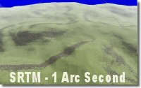
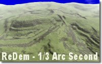
I am experimenting with a new version of ReDem that accepts additional DEM formats, watch this page for updates.
Thanks to all who registered ReDem, I hope that it continues to help you with your routes.
Deanville